

Map
🗺️ Ongallur Grama Panchayat Ward Map
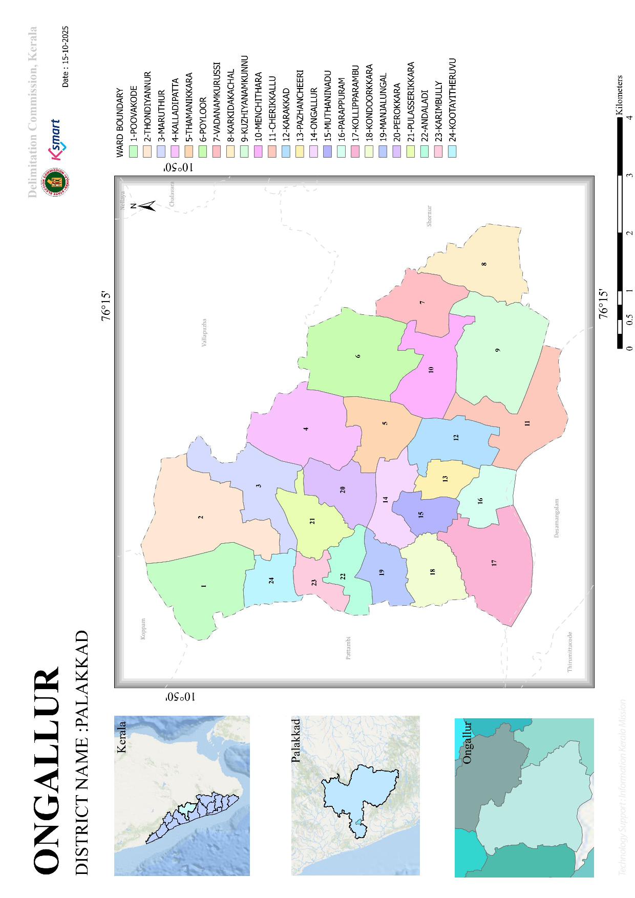
This is the official interactive GIS-based Ward Map prepared for Ongallur Grama Panchayat as part of the 2025 Ward Delimitation process in the local self-government institutions of Kerala. You can verify the final order and map issued by the Hon'ble Delimitation Commissioner, fixing boundaries by dividing Ongallur Grama Panchayat into 24 constituencies in accordance with Section 10 of the Kerala Panchayat Raj Act, 1994.
🌐 Interactive Ward Map
You can visit the official GIS-based ward map of the Panchayat by clicking on the image below or using the provided button.
✨ Key Features of the Map
- Ward Boundary Information: Clearly displays the revised ward boundaries based on the 2025 Ward Delimitation.
- Interactive Navigation: Enables zooming in/out, precise verification of areas, and easy identification of various locations.
- GIS Technology: Utilizes state-of-the-art GIS technology to provide accurate geographic information to the public.
⚠️ Please Note: If the map is not fully accessible embedded within the website due to certain browser security restrictions, you can use the “Open Map in Full Screen” button above to open the map with complete features in a new window.